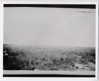
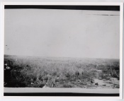
Area around B18 Wreckage (4.14.0335)
From The BenHaven Archives
| Area around B18 Wreckage | |
|---|---|
 Page 1 | |
| Original Location | |
| Place | |
| Latitude/ Longitude |
|
| Physical Characteristics | |
| Pages | 2 |
| Photocopy/reproduction | No |
| Dimensions | Unknown |
| Sources | |
| Creator/Origin | Unknown |
| Donor | Al Young Studios |
| Collection | Unincorporated |
| Date | 8 December 1941 - 31 December 1942 |
| Categorizations | |
Area around B18 Wreckage (BenHaven archives reference no.: 4.14.0335)
Provenance
This document is Artifact 4.14.0335 in the BenHaven Archives.
Artifact scans
Notes
Related Artifacts
External Links
Categories:
- Pages where expansion depth is exceeded
- Artifact
- Philippines
- Original Documents, Images, and Artifacts
- Artifacts with unknown origins
- Unincorporated into a collection
- Photos
- 1941 Artifacts
- December 1941 Artifacts
- 8 December 1941 Artifacts
- 1942 Artifacts
- December 1942 Artifacts
- 31 December 1942 Artifacts
- Artifacts requiring review
- B18
- Bomber Aircraft
- Aircraft
- Aircraft Wreckage

